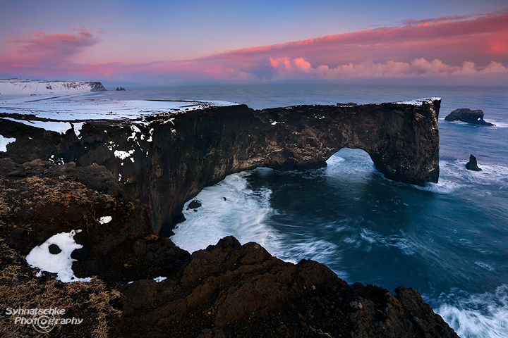
Dyrholaey Arch near Vik i Myrdal

SUNSET AT DYRHOLAEY ARCH
This month's image shows a winter sunset at Dyrholaey Peninsula. It is an obligatory stop along Iceland's South Coast - during summertime and also in winter. And if you are lucky, there might be some fresh snow making the black lava sand beaches around Vik i Myrdal even more scenic.
The turnoff to Dyrholaey from Iceland's Ring Road is located 12 km west of the village of Vik i Myrdal. A paved road leads south over a dam and ends after nearly 6 km at the lower viewpoint. The (unsigned) sidetrip to the lighthouse and upper overlook leaves this road to the right near its end. It is steep, unpaved and usually "ófaert" (=impassible) in winter. But just like we did, you can walk along this road. It's 1,5 km uphill and there is a ~400 ft elevation gain. From the cliffs behind the lighthouse you will be able to see two different arches: the large one just below the dark cliffs (Dyrholaey Arch translates "door hole island arch") and a second smaller one to its right out in the sea. Note: Access might be also limited in late spring and this road might be closed to protect the nesting seabirds (puffins!).
The lower overlook is usually easy to reach by car and the view towards the Reynisfrara beach is absolutely breathtaking. In the foreground there is Arnardrangur ("eagle rock"), and in the far distance just below the steep cliffs of Reynisfjall you will see the Reynisdrangar basalt sea stacks. Those pinnacles are also called Skessudrangur, Landdrangur and Langsamur and according to a legend they are trolls surprised by the daylight and turned to stone. This is an image we took on the next day at the -> lower viewpoint of Dyrholaey.
Image data: 2,5 s at f/16, ISO 100; Canon EF 16-35mm 1:2,8 L II USM at 18 mm, Canon EOS 5D Mark III
Related Links: Our "Iceland Photo Galleries"
